Yongmeori Coast — 1.8 Million Years of Sandstone, Southwest Jeju
A Short Cliff-Side Geo-Trail Where the Island's Hydrovolcanic History Reads Like Pages Under Your Feet
Yongmeori Coast is a coastal cliff geo-trail in Andeok-myeon, Seogwipo-si, directly in front of Sanbangsan. The full loop runs about 600 meters and takes 20–30 minutes. The layered sandstone tuff, deposited by hydrovolcanic activity roughly 1.8 million years ago and exposed by wave erosion, forms vertical walls and sea caves. Adult admission KRW 2,000. Entry is restricted on rough-sea days and at high tide.
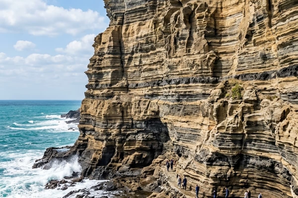
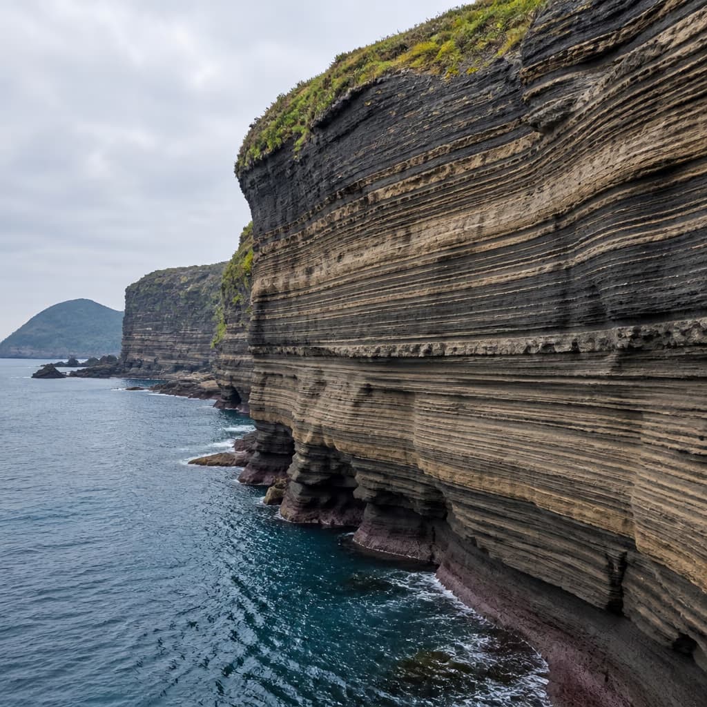
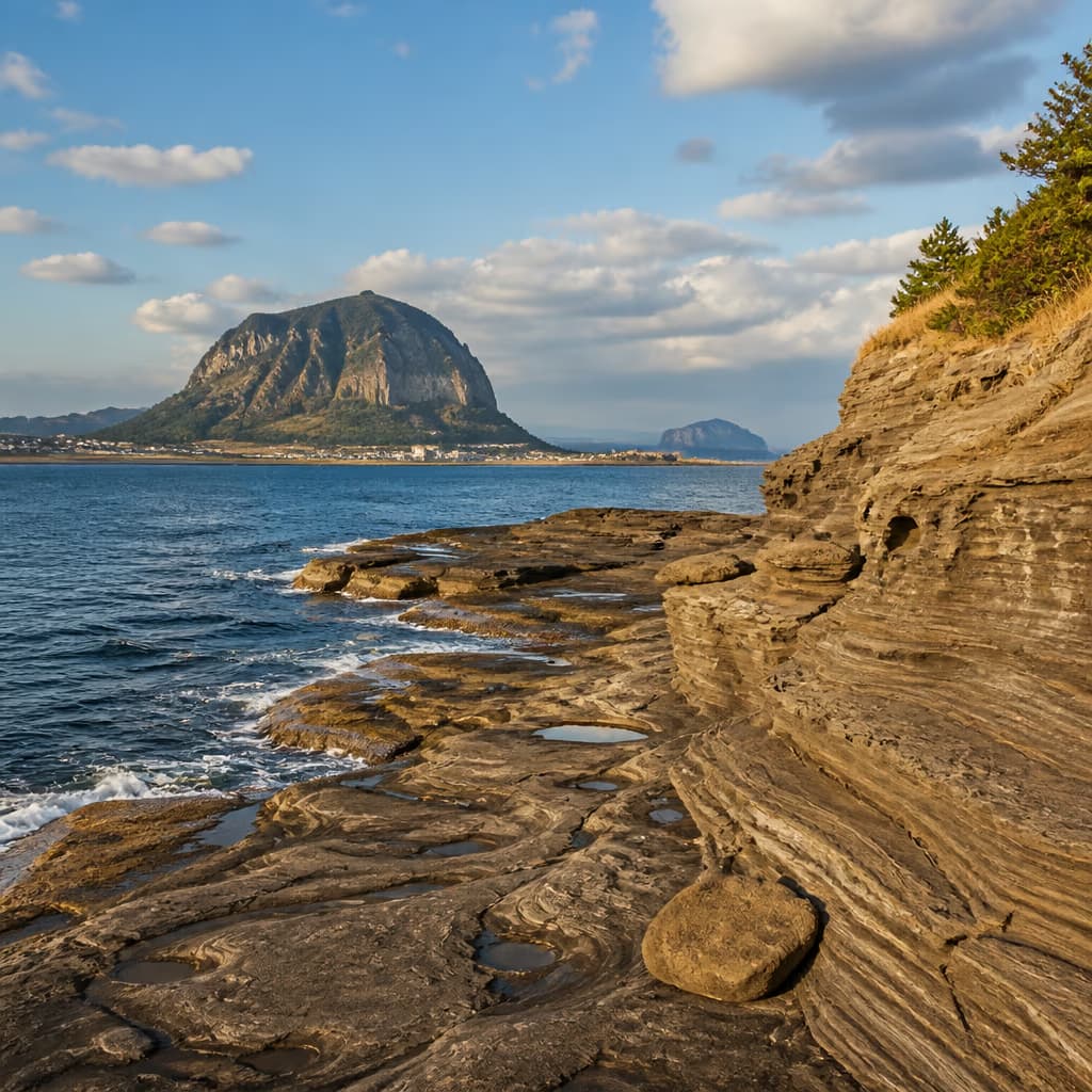
Step down from the foot of Sanbangsan toward the sea and a cliff face appears with millions of years stacked vertically. Yongmeori Coast is widely cited as Jeju's open-air geological textbook — layered sandstone tuff, formed by hydrovolcanic activity about 1.8 million years ago, slowly uncovered by wave erosion. The long shape of the cliff stretching into the ocean is said to resemble a dragon pushing its head out of the sea, which is where the name comes from.
The full loop is about 600 meters and walks comfortably in 20 minutes. What changes the experience is the awareness that each curve and stripe in the rock under your feet is a sedimentary record measured in hundreds of thousands of years. Designated Natural Monument No. 526 in 1995, it has hosted both scientific surveys and ordinary visitors ever since — one of the signature sites of southwestern Jeju.
The 1.8-Million-Year Story at a Glance
These cliffs are not the product of an ordinary volcanic eruption but of <strong>hydrovolcanism</strong>. When magma met groundwater or seawater the eruption became explosive, and the water-mixed ash settled in thin layers that hardened into the striped sandstone visible today. Compared to a normal lava flow, the grain is finer and the multi-layered structure is more distinct — the defining trait. Diagrams of each formation stage are available at the Jeju Global Geopark portal.
Within the tuff layers, traces of weathering and erosion show up in different patterns by period. Some layers are very fine-grained; others embed small pebbles. The contrast carries information about the intensity and frequency of eruptions. Among <strong>outcrops that volcanologists cite</strong>, this one is regarded as a particularly well-preserved key reference.
How the Trail Is Laid Out
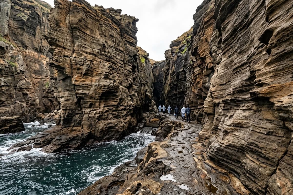
A staircase from the entrance drops you between cliff walls more than ten meters tall on both sides, and the narrow path begins. The cliff face shows clean horizontal stripes — water-borne ash from each hydrovolcanic burst, layered and consolidated into tuff. Step close and the grain size and tone change from band to band, all visible to the unaided eye.
About halfway around, a sea cave appears. Waves carved through the softer lower layer, leaving a natural arch; standing inside and looking outward, the horizon frames itself like a picture in a window. Interpretive panels at every major point cover the essentials without needing a guide.
Watch the ground carefully and small shell fossils or pebble-embedded sections turn up. These are evidence that the area sat under shallow sea during formation — one reason school field trips come here regularly.
A Half-Day Loop with Sanbangsan
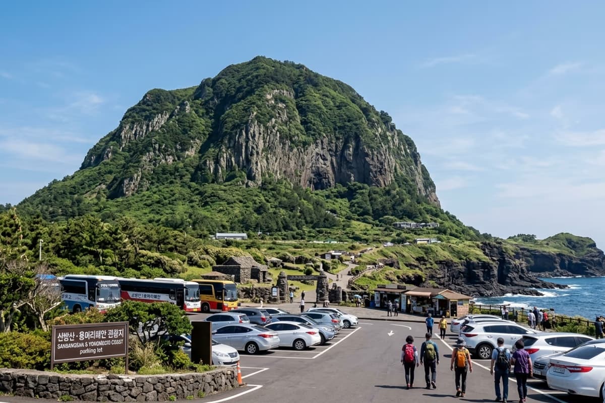
The Yongmeori cliff path and Sanbangsan share the same parking lot, and the two together can be unhurried in about two hours. Sanbangsan (395m) is a bell-shaped dome eroded from an old lava plug, and the climb to mid-mountain Sanbangguksa takes around twenty minutes. Inside the cave shrine, water drips from the ceiling while the southern sea spreads out beyond — a quietly unusual frame.
Climbing Sanbangsan first and cooling down on the cliff path afterward is the better order for energy management. A small kiosk at the Sanbangsan entrance sells barley bread and tangerine juice for a quick refuel. Visit Jeju carries unified information for Sanbangsan and the surrounding area.
Weather Restrictions & Visiting Tips
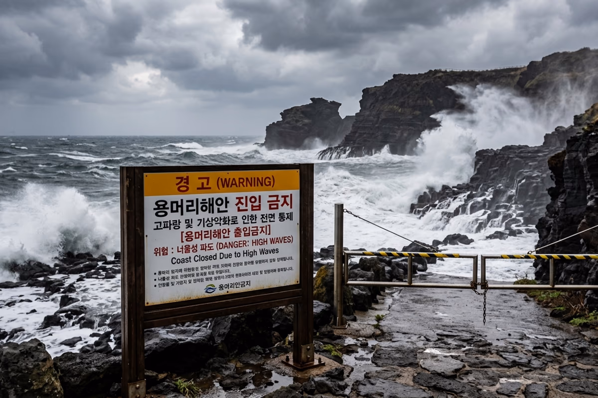
The cliff trail closes by weather rather than rain alone. When a high-seas warning is in effect, when wave height exceeds 2.5 meters, or during high tide, the loop is shut. Same-day status can be confirmed at the on-site board after 9 a.m., or by calling the Seogwipo City Tourism Office at 064-760-3941.
Admission is KRW 2,000 (adult) and KRW 1,000 (child), separate from the Sanbangsan ticket. Much of the path is wet underfoot, so non-slip sneakers are recommended. Sandals and high heels may be restricted on safety grounds. Visiting at low tide opens the corridor between cliffs to its widest and lets you look closely at the lower depositional layers.
Comparison with Nearby Geological Sites
Southwestern Jeju holds sibling outcrops from related periods. <strong>Songaksan</strong> is a younger tuff cone formed by an eruption about 7,000 years ago — far more recent than Yongmeori. <strong>Suwolbong</strong> is the product of an explosion roughly 18,000 years ago, with its pyroclastic layers cleanly exposed in another reference cliff. Touring all three in one day amounts to walking the timeline of Jeju's volcanic activity with your own feet.
For families, the children's geo-workbook distributed at the information center is worth picking up. The pictograms on the panels are matched to small missions in the workbook, so a child finds something to notice at almost every step.
Leaving the Cliff for the Western Sea
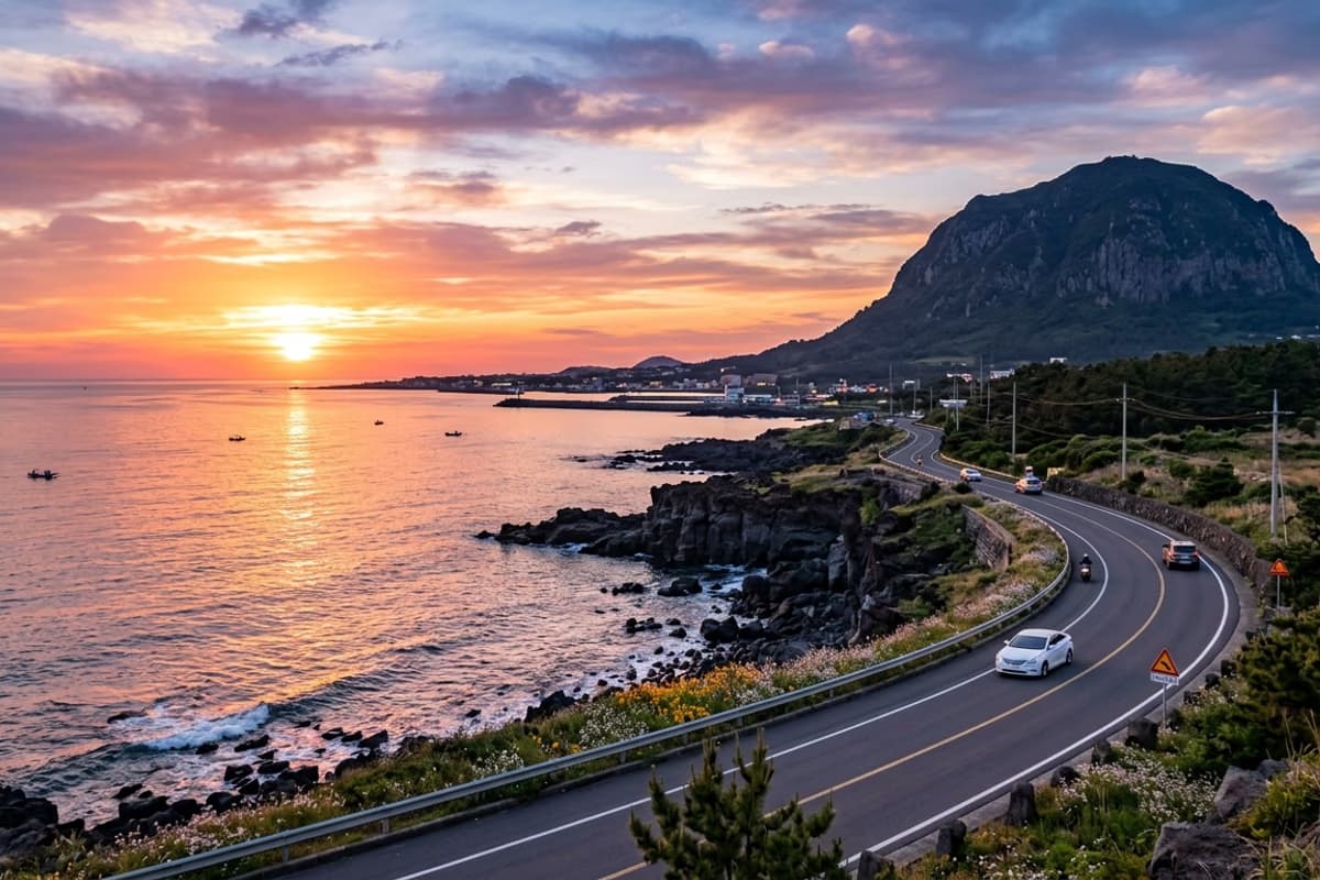
Heading north out of this site, going through Hallim, the road reaches Aewol in roughly 40 minutes by car. An afternoon visit followed by the coastal drive holds the sea on the right and the silhouette of Hallasan on the left for long stretches — an hour worth keeping on its own. Timed to sunset, the warm orange spreading across the water passes the windshield.
For a broader southwestern loop, ten minutes west of this trail lies the Alddreu Airfield site in Daejeong-eup and the Songaksan ring road, which together stitch volcanic geology, modern history, and an easy walking path into one continuous course.
Natural Monument Designation & the Meaning of Preservation
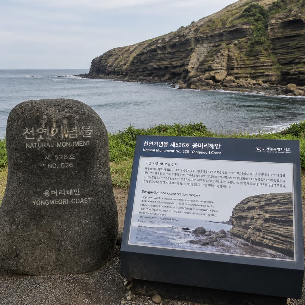
This cliff trail came under national protection when it was designated <strong>Natural Monument No. 526</strong> in 1995. Before designation, isolated reports described visitors scratching the surface or breaking off small pieces of rock. After designation, protective fences and panels were updated, and the routes for academic surveys and general visits were clearly separated.
Surface damage to the rock takes decades to repair naturally — a point emphasized on the panels themselves. When a companion or a curious child reaches out to touch or scrape the sandstone, a gentle word of explanation goes a long way. The rock looks solid but in places is soft enough that even a fingernail can lift a small grain.
Reading the Landscape Through the Sanbangsan Legend
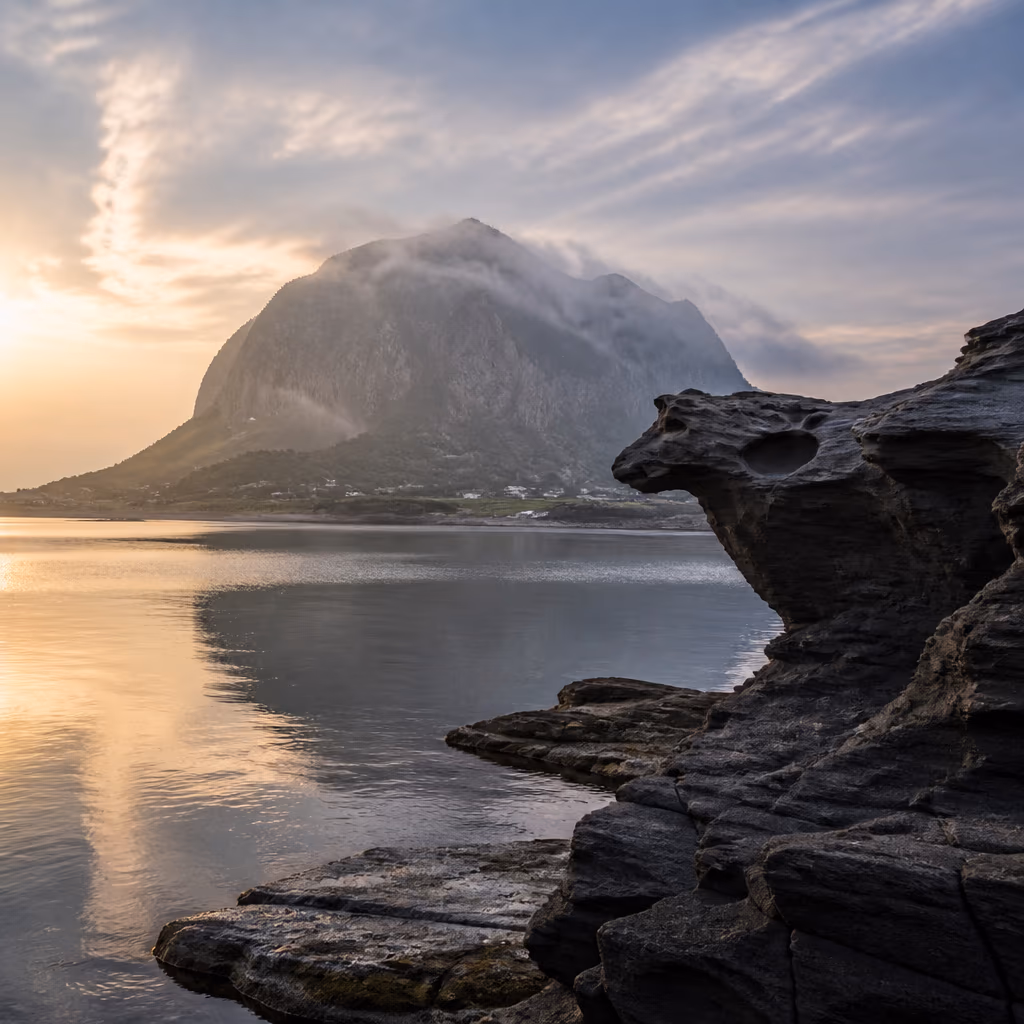
Sanbangsan carries an old story that the peak of Hallasan was pulled out and set down here. The story rests on the curious match between the rim of Baekrokdam, the crater lake atop Hallasan, and the outline of Sanbangsan's summit. Walking with that story in mind, the sandstone under your feet and the bell shape overhead settle into a single picture.
In modern art history, <strong>painter Lee Jung-seop</strong> is known for taking this area into his canvases repeatedly. A handful of sketches made during his stay near Sanbangsan are on display at the Lee Jung-seop Art Museum in Seogwipo. Pairing a museum stop with the Sanbangsan-and-cliff loop makes for a half-day of nature and the humanities overlapping.
How to Time the Tide
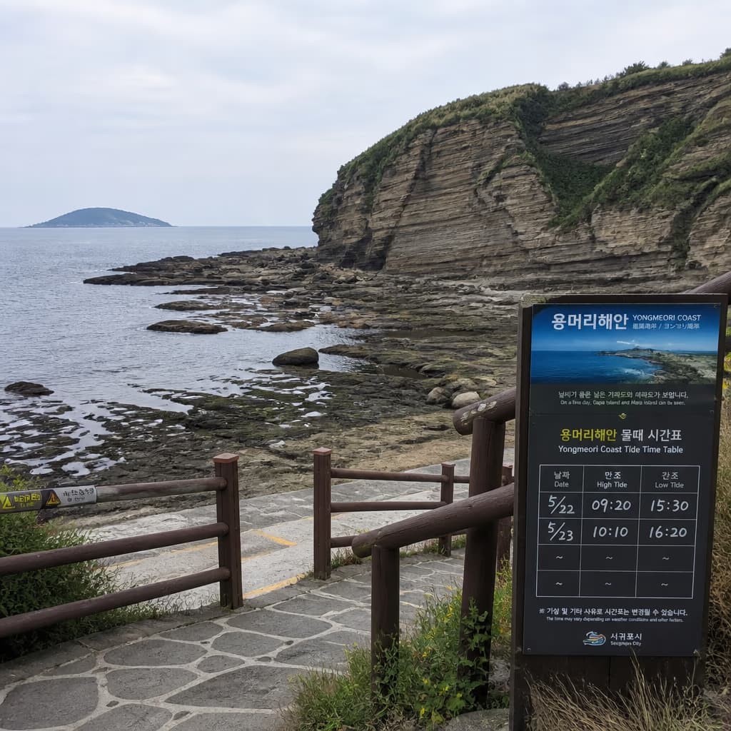
The trail shows its real face at low tide. At high tide, entry can be blocked outright, and the corridor narrows enough that photographs feel cramped. Using the Korea Hydrographic and Oceanographic Agency Marado tide station data, the day's low and high tides are visible to the minute. The window from one hour before low tide to one hour after is usually when the corridor is widest and the lower depositional layers are easiest to observe up close — the actual golden hour of this site.
For photography, picking the low tide whose light strikes the cliff at an angle gives the best result. Midday vertical light flattens the relief of the stripes; the diagonal light around 9–10 a.m. or 4–5 p.m. casts clear shadows on each layer and brings the texture of the sandstone forward in the frame.
A long-exposure ND filter softens the wave fronts hitting the cliff base into something close to flowing mist. Tripods are permitted only inside the entrance fence, and in narrow stretches the courteous practice is to keep setup-and-collapse time short so other visitors are not blocked. Weekday mornings often draw school group surveys; for a quieter shooting environment, late weekday afternoons tend to work best. Right after rain, when the wet sandstone deepens by a tone, the cross-section stripes become more pronounced — a short window photographers regularly aim for. With a companion, one person can read the panels while the other moves in for the close-up — the division of labor is efficient.
Frequently Asked Questions
- Can Yongmeori Coast be visited on rainy days?
- The decisive factor is wave height and wind, not rain itself. The trail closes when a high-seas warning is in effect or when wave height exceeds 2.5 meters; rain with calm wind and sea can still allow entry. Confirming on-site that morning is recommended.
- How long does Yongmeori Coast take to walk?
- The 600-meter loop walks briskly in about 20 minutes. Adding photography and reading the interpretive panels brings the visit to about 30–40 minutes — enough for most travelers.
- How much time do I need to combine Sanbangsan with Yongmeori Coast?
- About two unhurried hours for both. Sanbangsan up to Sanbangguksa and back is roughly 40 minutes; the Yongmeori loop is roughly 30 minutes; adding walking between and a brief rest, two hours is about right.
- How far is it from Yongmeori Coast to Galchibada in Aewol?
- About 40 minutes north along the coastal road. The drive passes through Hallim and the Aewol coast — a scenic stretch in its own right.
After walking on ancient sandstone, a table forty minutes north
From geological time underfoot to a coastal dinner table
After walking on layers measured in millions of years, the same coastline reaches Aewol in forty minutes by car. The sea framed beyond the floor-to-ceiling window is the very one you just left, and on the table sits one whole wild silver hairtail with a slice of lemon beside it.
Forty minutes from Yongmeori Coast to Galchibada in Aewol via the coastal road →